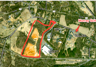
Aerial – 2 Dettor Road, Ivy, Virginia
Faulconer Construction Company, Inc. has made substantial development improvements to the Ivy Site property off of Dettor Rd. The timber on approximately 12 acres of the 26 acre site (encompassing two (2) building pad areas) was clear cut and the stumps removed. Topsoil was stripped to a depth of six inches across the area to be graded and stockpiled for re-spread later. Earthwork cut to fill of roughly 50,000 cubic yards of dirt was performed, which is approximately 75% of the work required to achieve the finish grades shown on the approved Site Plan designed by the engineering firm, Roudabush, Gale & Associates. In accordance with the Water Protection Plan, designed by the Williamsburg Environmental Group; two storm water management basins were installed, including structures and outlets, and two stream crossings were installed as well as two (2) fill embankments completed to provide access throughout the site across the two live streams. At the completion of this construction phase, the entire site was permanently seeded and the buffer mitigation work, via reforestation, outlet protection retrofit, and culvert removal through an old roadbed, was completed as required.
During the course of construction, Faulconer maintained the Storm Water Pollution Prevention Plan (SWPPP) permit as required, as well as the Virginia Pollutant Discharge Elimination System (VPDES) permits, and the Virginia Water Protection (VWP) permit.
Design Engineering contact:
Mr. Bill Ledbetter
Roudabush, Gale and Associates, Inc.
914 Monticello Road
Charlottesville, Va. 22902
434-977-0205
Property Details
Address: 2 Dettor Road
City: Ivy
State: Virginia
ZIP: 22903
Square Feet: n/a
Bedrooms: n/a
Bathrooms: n/a
Basement: n/a
Additional Features:
Click here to download the Topo Map (PDF)
-
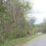
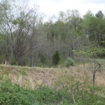
- Site is on the left looking North up Dettor Rd.
-
- North side stream crossing the entrance to the north side of the site
-
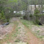
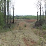
- Access point off of Dettor Rd. to the south side of the site
-
- North side stream crossing looking toward Dettor Rd.
-
- Second stream crossing which connects the North and South portions of the site.
-
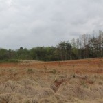
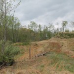
- View of the south side of the property
-
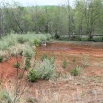
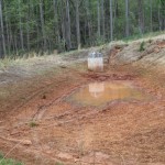
- View of the basin at the south end of the property
-
- North Sediment Pond
-
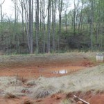
- North sediment pond, the wooded area beyond the pond is the stream buffer, and the clearing in the background is the south side of the site.

Speak Your Mind